
Boom football is FINALLY here!!!!!!!
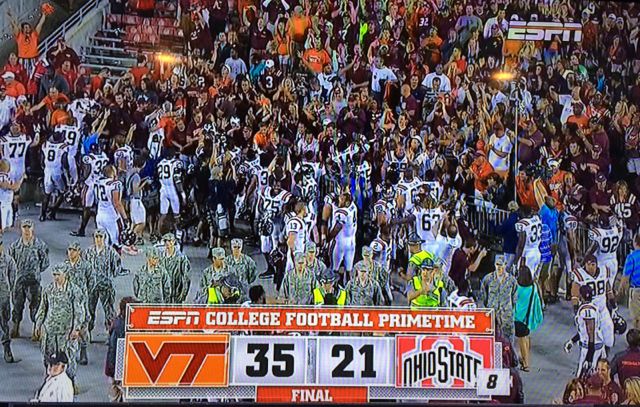
Well, it's time for a new chapter in my life. For the first time in six years I write to you about a home game I won't be watching live. A new chapter has begun in my life and I write to you from beautiful Madison Wisconsin!!! (Seriously it's amazing) they too have a big game this week but it is nothing when compared to our own. In case you didn't know OHIO STATE IS COMING TO LANE STADIUM! Yes the same Ohio state we beat, who then went on to win a championship. Tickets are going for a whopping 200$ in some places... student tickets! In case you didn't notice I'm pretty sad I'm missing this but I'll be jingling my keys at my apartment screaming until I get a noise complaint..
sorry OSU fans I couldn't resist
But I'm not here to talk about my life, no I'm here to begin the return of the weekly weather report and let me tell you it's gonna be a happy one I get to deliver. I have a really good one planned later this year but alas this isn't going to be it (don't have my desktop at the moment so I'll more discuss some simple stuff that won't take pretty pictures and charts and maps! (Your key play weather man is actually designing a 101 class and has access to awesome stuff)

pretty much how my classes run
Any who let's talk about winds and different levels of the atmosphere. Not just any old winds let's talk about winds that really drive weather systems and what things do higher up. Well first let's do some weather lingo... when I say millibars or, Mb, what I'm talking about is the pressure with regards to a certain height. So at 1000mb we are talking about the surface of the earth. 850 Mb would be a little higher, roughly 5000 feet above sea level (as there is less pressure acting on us from the atmosphere) now as we get higher there's a few other checkpoints we really need to take note of. Those are 1000 mb, 850 Mb, 700 mb, 500 Mb, 300 mb. Each of these different heights offer different tools for forecasters particularly multiple days down the lines, although sometimes in the case of troughs and ridges perhaps for that very day as well.
oooh pretty weather
So let's start with 850 Mb winds since I think you guys know a thing or two about winds on the surface (think pressure systems, winds traveling from high to low pressures). The 850 Mb heights are my primary weapon of choice for the winter season. Primarily because this level is a really good indicator of the planetary boundary layer, which can tell you a lot about the types of your precipitation. Typically if you have a cold below freezing temperature up here and a cold temperature at the surface along with a really saturated column of air (lots of moisture) you'll get some snow. However if the temperature is above freezing and the layer below is below freezing you can get freezing rain. But wait how does this happen? I thought air cooled with height?! Well my dear friends when you introduce lots of pressure at the surface the temperature gradient reverses (think ideal gas law) making the air closer to the ground colder than the air above it. That can happen via a warm less dense air mass moves over a colder region. Wow I just got super off topic.... But anyhow back to 850 Mb! These things are also good for determining the strength of high and low pressure systems and cold air advection and warm air advection. (Basically meaning cold air moving into a warm region or warm air moving into a cold region)

decent picture of the 850 charts
Next up are the 700 Mb winds. These winds are really good at showing us where our caps are. When I say cap I don't mean like busting a cap...

but really I've heard meteorologists talk about caps busting...
Rather a cap on top of the possibility of severe weather. A cap is basically warm air aloft that needs to be overcome in order for weather and bad stuff to happen. They usually occur due to inversions in the atmosphere (warm air above again) and because warm air rises the ground temperature must get higher than the air in the atmosphere to start rising naturally. This can happen in a multitude of ways such as heating during the day, a mountain, a cold front...etc. some way of lifting the air! More importantly on a large scale, this is where we see troughs and ridges which...I'm sure you've all heard at some point. These are essentially changes in the height contours that look kind of like a sinusoidal wave...or like any wave I guess. The ridge is the top of the wave and typically indicates beautiful weather. The trough is the bottom of the wave and indicates low pressure systems aka mid latitude cyclones. Also SUPER IMPORTANT are short waves. Short waves are small little kinks in the atmosphere that represent a significant disturbance in the atmosphere. THESE HAVE LOTS OF INSTABILITY AND BAD WEATHER, they're like a dead giveaway due to the fact that they represent significant temperature changes in a short timeframe.

pretty textbook example
Next up continuing our journey into the atmosphere are 500 Mb heights... aka the beginning of a meteorologists upper atmosphere (but really it's the middle atmosphere). These levels are super important due to virginity. I think I touched on this briefly before however I'm going to cover it again just to be safe. Vorticity can be thought of as spin. Counter clockwise spin up here represents positive vorticity which allows lift to occur and brings air upward into the atmosphere. Oppositely clockwise spin indicates negative vorticity and forces air downwards stopping lift. This is indicated in a change of curvature of the winds. Also important to look at is speed shear. Speed shear is the increase of speeds of winds as they go through the atmosphere. Typically associated with lift and positive vorticity is increased speed sheer. Think of it like a traffic jam. If it's all backed up you slow down just like the winds. This forces downward motion from the atmosphere and prevents air from lifting and creates high pressure systems. Likewise if the traffic speeds up and you start driving faster there's going to be a gap in traffic which represents the winds. If there's this gap the atmosphere compensates and fixes it by forcing winds upward resulting in lift. Our giant traffic jam is changing daily due connotation of the earth, heating, Coriolis, and pressure gradients!!! Mind you this is kind of simplified

vorticity and jank!!!
Last but not least are the 300 Mb winds which can also be referred to as the 200 Mb winds. This is where the jet stream is located. It fluctuates during warm and cold seasons due to the density of air. During the cold season it lifts to 200 Mb whereas it hovers around 300 Mb during the warm season. The jet stream is basically the driving force for all things troposphere. It pushes your highs and lows and can quickly turn violent due to jet streaks. Jet streaks are essentially where the air quickly gets much faster and can drive the formation of a trough which of course can cause severe weather. Jet streaks are divided into four quadrants with the right rear and front left creating rising air and the left rear and front right creating descending air. This is due to Coriolis forces rotating systems beneath the streaks that the streaks are creating. This happens typically when the winds start bending in directions, if they're all flowing in the same direction it's usually a pretty quiet day. Also importantly the jet stream can divide warm and cold weather. South of the jet (in the northern hemisphere) is usually very warm. North of the jet on the other hand is very cold. The jet moves around a lot during the changes of seasons.

tada the jet stream!
Now that we've done a little weather briefing on forecasting lets discuss this weekend shall we?!
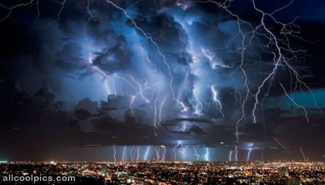
this should be a decent hint of what's to come
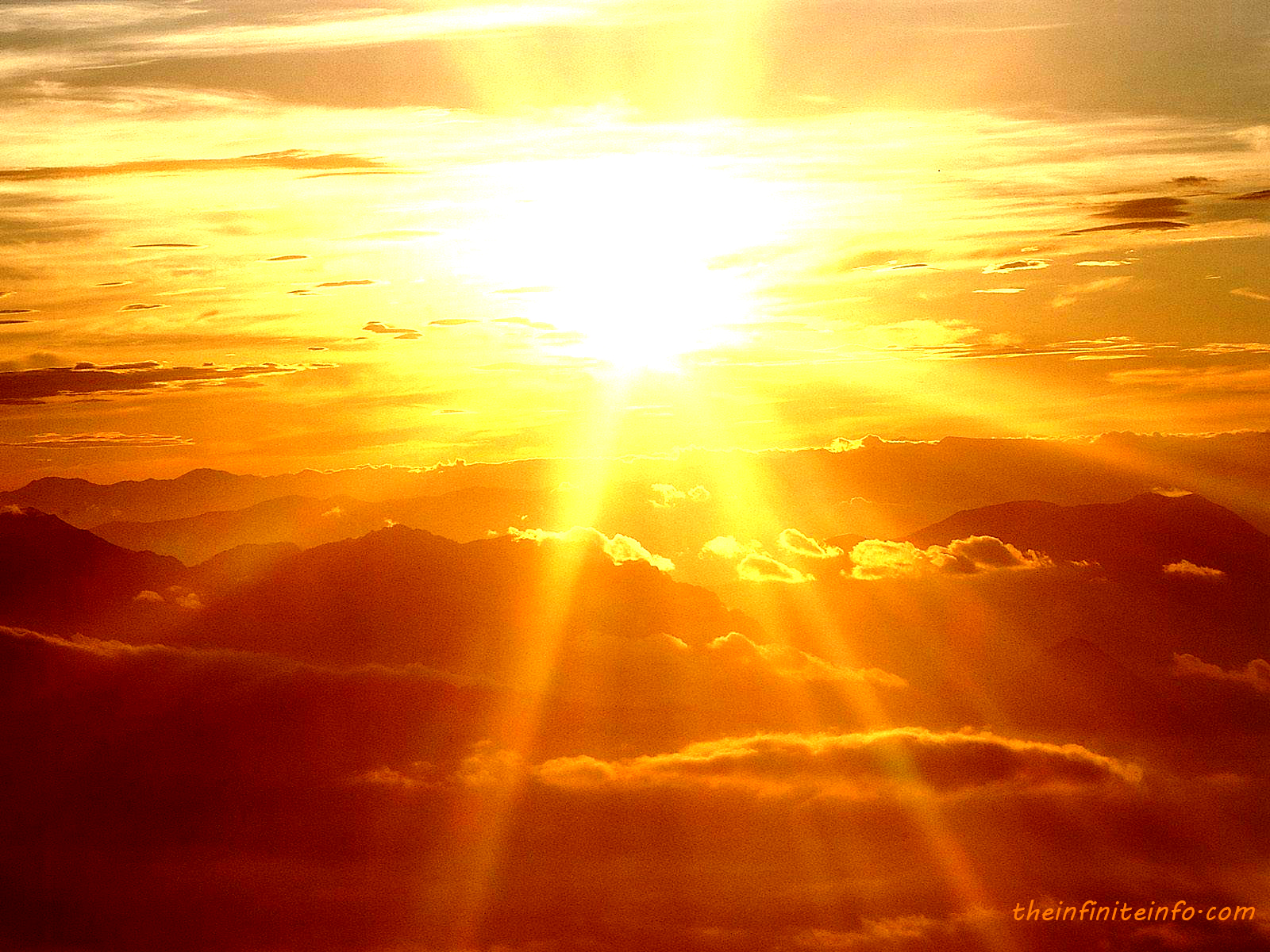
Driving down this weekend you're going to be looking at some thunderstorms as a low over Ohio sweeps east bringing with it some thunderstorms and rain. Luckily this beautiful low over Wisconsin is going to break it up Sunday and leave us with quite possibly the most beautiful Monday football tailgating weather I've ever seen. So while the boohoos will be drowning in rain after yet another opening season loss Saturday we'll be prepping for a gorgeous Sunday night and Monday. The highs should be around 79 or 80 with lows dropping out around 65 under partly cloudy skies. The winds should be basically nonexistent too! Hopefully this leads to some great tailgating and an incredible home atmosphere as our boys in maroon attempt to pull the upset for the second straight year in front of what promises to be one of the best crowds in Lane Stadium history!!!!!
How this all plays out on the field
Well frankly I'm glad it's gonna be clear. Our fans are going to be louder and raunchier than ever (and I'm damn near depressed I'm missing it) yet the buckeyes definitely have the more athletically gifted team. For that reason I'll call it a wash....if anything the buckeyes have an advantage, although in a rainy game more explosive teams have a significant advantage and frankly OSU is definitely more explosive...so let's just be happy it's not raining! This game will be won on the trenches. While I don't think Ohio State is going to drop 40 on us I do expect them to score and move the ball, thus our offensive line MUST get some drive against a defensive line missing its best player. Furthermore it has to protect brewer. If that can happen the hokies can certainly walk out victorious but that is a BIG IF

thanks for the pic Joe!!!
Final predictions
Lane will be ROCKING
Wind gusts maybe around 5 mph
High temperature 79
Low 65
Partly cloudy
Lots of grilling
No precipitation
Kickoff 69 degrees
Awesome football
Go Hokies!!!!!!

class act by both team!!!!
PS shout out to the lovely buckeyes over here during the offseason I've loved reading your insight! B1G country is pretty cool
Comments
Please join The Key Players Club to read or post comments.
Please join The Key Players Club to read or post comments.
Please join The Key Players Club to read or post comments.
Please join The Key Players Club to read or post comments.
Please join The Key Players Club to read or post comments.
Please join The Key Players Club to read or post comments.
Please join The Key Players Club to read or post comments.
Please join The Key Players Club to read or post comments.
Please join The Key Players Club to read or post comments.
Please join The Key Players Club to read or post comments.
Please join The Key Players Club to read or post comments.
Please join The Key Players Club to read or post comments.
Please join The Key Players Club to read or post comments.
Please join The Key Players Club to read or post comments.
Please join The Key Players Club to read or post comments.
Please join The Key Players Club to read or post comments.
Please join The Key Players Club to read or post comments.
Please join The Key Players Club to read or post comments.
Please join The Key Players Club to read or post comments.
Please join The Key Players Club to read or post comments.
Please join The Key Players Club to read or post comments.
Please join The Key Players Club to read or post comments.
Please join The Key Players Club to read or post comments.
Please join The Key Players Club to read or post comments.
Please join The Key Players Club to read or post comments.
Please join The Key Players Club to read or post comments.
Please join The Key Players Club to read or post comments.
Please join The Key Players Club to read or post comments.
Please join The Key Players Club to read or post comments.
Please join The Key Players Club to read or post comments.
Please join The Key Players Club to read or post comments.
Please join The Key Players Club to read or post comments.
Please join The Key Players Club to read or post comments.
Please join The Key Players Club to read or post comments.