
Well, without getting all sentimental this will be my last weather report as an undergrad barring a spring sports team makes a run at a national championship (looking at you softball/tennis), but I'm going to carry on the reports into next fall and through grad school because I love you guys so much.
Sentiments over, onto the spring game! With last year's topsy turvy results and highs and lows its been an interesting offseason and for the first time in a long time I have no idea what to expect next season. There's a whole lot of ifs on the defensive side of the ball that could have them being anything from one of Foster's best units in years, or have them struggle out of the gate to start the season (which still means a top 25 defense for our standards and much higher regarded than the #1 third down defense in the country up north).

they love that stat dont they?
.jpg)
As for the offense things are looking up, for once in god knows how long Stacy Searels has put together some blue collar boys on the offensive line that actually want to hit someone in the mouth. I plan on starting a new trend at grad school with pancakes for the line, where I'll keep a tally every game for Wyatt Teller's pancakes and make that many the morning after....I plan on eating a lot of pancakes. The QB situation is as interesting as its been in a while in Blacksburg, with Brewer being a little turnover prone last season a lot of fans were calling for his head, all of the evidence this spring however has said he's looked really sharp and he was also battling an injury most of the season. I'm a little weary of spring however as last spring Louisville's QB was being touted as a preseason Heisman candidate due to his spring game numbers and...well he wasn't and that defense was a lot better than the spring indicated. However I still believe in a full offseason Brewer will be much improved this fall, and I love his improvisation skills in the pocket.
All of this and more will be played out this Saturday at the spring game! Orrrr...will it?
The past couple of days the models of been showing a significant chance of rainfall this weekend but hemming and hawing at when exactly it would hit. To better understand how model's work first I'm going to break out the one storm that meteorologists love to pat themselves on the back about. That one being Hurricane Sandy, meteorologists absolutely nailed this forecast, only being really significantly off on their forecast a good 120-hr beyond the range and even then they were a mere 15 miles off of the strike zone....thats REALLY freaking impressive, 120 hours before it actually happened they knew within 15 miles of where this massive super deadly storm was going to hit.

proof
Now why was this one so accurate when your lovely local TV man cant hit the thunderstorm outside your house at 4PM? Well it has to do with scale, for starters. Large scale massive air movements are predicted on a daily basis pretty accurately, we know within a general vicinity when a big ole sweeping low is gonna come across the east, or when a 500 millibar ridge is gonna park its way over the midwest and bring in a lot of hot air, but what its going to do on a fine 20 mile radius can be pretty tricky. Conditions are different everywhere and a lot of our information comes from satellites and weather balloons and since we cant shoot up weather balloons or have satellites covering every square inch of the Earth at all times we do have to do a little bit of estimating in between. We know that a storm might move through the trough and based on the winds we might know the general vicinity it will hit at but whether its going to hit your town or the town 5 miles west of you can be a little bit of using judgement based on conditions at each town and for that meteorologists get a bad rap sometimes. Sandy was also revolutionary in its forecasting methods as everyone saw the potential for a doomsday $hit show situation with the trough combining with the tropical system. As a result meteorologists all over the country started launching weather balloons on a much quicker basis (rather than twice a day it was as much as every few hours. National weather service stations do this often when a big storm or something bad is going to happen but very rarely is it done on a national scale like it was. and as a result we had a really clear picture of what the atmosphere was doing across the entire country and numbers being crunched into the models a lot quicker. Why don't we do this all the time? Well weather balloons are made out of silicon which aint cheap. This is not a cost effective idea AT ALL and would result in basically all of our weather stations running out of money in no time.
So you have all of these balloons crunching in numbers and you also had the work of some polar orbiting satellites feeding all of this data to get a magnificent prediction for Sandy, Ball Aerospace recently did some research and pulled the polar orbiting satellites from the model data just to see what would happen (why not?) and the storm veered off the coast and into the Atlantic, basically meaning we would have had like 6" of snow in the northeast. Basically the polar orbiting satellites helped a tremendous deal with global wind patterns to NAIL this forecast.
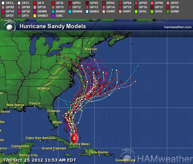
pretty picture of different models' forecasts the euro (GO EURO!) and gfs (AMERICA) wound up hitting the forecast the best

Sandy's actual track
So what the hell does all of this have to do with the spring game? well with the troughing coming in from the west we know that some rain patters are coming in, but here comes the minutia of it all. When and where its going to hit is a little bit more tricky, we know this is gonna be a widespread rain pattern with not to much convective stuff mostly because the potential just isn't there. So basically its going to just be a cool rainy day without much wind on a large scale, because of that its all a prediction of when it will hit, and its starting to look like its going to start drizzling in the morning picking up around 2-6oclock and then carrying on through the night and into sunday. That being said I still expect a much better turn out than 3000-4000 fans (looking at you Charoletsville community college)
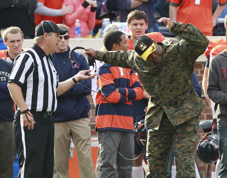
Mike London is breaking this bad boy out to camouflage into the crowd and take notes
I'm not entirely sure what Tech's cancellation on the spring game policy is but weather is not going to be good. Its going to be rainy and a little chilly with highs reaching around the mid 50s and lows reaching the low 40s. The heaviest part of the system will be moving through right around kickoff with precipitation rates reaching around .2 inches per hour. While you shouldn't be expecting a freaking monsoon it is going to be a dreary rainy day in Blacksburg, luckily the thunder is going to hold off so I highly doubt they'll cancel the spring game, and I'd really like to see some fan support show up for the game!

awwww yeah look at that crowd support
How it will play out on the field:
I HAVE NO FREAKING CLUE, seriously i have no idea what Beamer and company are going to do as far as the gameplan for the scrimmage, but I would expect some big gains and a lot of slipping and sliding all over the place. bring a poncho and it might get kind of entertaining. I still expect big plays from the receivers and only fear that nobody suffers from the RGIII injury due to the field getting a little torn up (although frankly I think our fields are in better shape than the Redskins').

That being said it would still be a fun afternoon outing and I highly recommend everyone and anyone goes to show their support!!!!!
Final reports
Rain - yeah....a good bit
clouds - yeah...lots
High 56
Low 46
thunder - nadda
wind - 3-5 MPH gusts
VT offense shows improvement, VT defense (missing numerous starters) looks solild
VT wins
UVA loses

GO HOKIES!!!!!!!!!! #BeatOhioState

Comments
I am glad that you are good at this weather jazz. I have been looking at the radar out west and I just have not seen any fronts form. I guess that stuff down south is going to move north?
Yeah northeast, if you run a search on 500mb winds you'll get to see what's really driving the weather. You get these troughs much like at the surface but they cause downward and upward motion of the weather. The trough is gonna be lingering across these next few days bringing the rain with it
Excellent post as always. Wish I could go, but the parents will be in town. I'm kind of hoping the weather is crummy in NOVA too so I can convince them we should stay in and let me watch it live.
Aaaand it's sleeting at my house. No worries, ponchos? check. Waterproof hiking boots? check. change of clothes? check. multiple options for drinking and good food before and after game? check.
Let's get after it folks, see everybody down there.
Let's Go.
Any updates? It looked like pop up storms but a breakup of the front around 1:00PM looking at the radar predictions. Weather.com has lowered the chance of rain from 90% to 65%.
Leaving Bristol now!!! Sooo looking forward to this. Looking like the weather could possibly cooperate.
LETS GO!!!!
Still seeing rain, that system in the southeast is gonna shift up there's a low pressure system in the Midwest that's going to pull the air up in the southeast into our region. The low pressure system is being brought in by that trough i mentioned in my forecast. Expect rain, dunno what weather.com is seeing but check out weather.gov they're typically really reliable.
Luckily its to cold for instability to build up so it should be just rain and drizzle...but cold drizzle. Drink lots and stay warm!
ESPN3 now shows kickoff at 11:00 AM.
Is this a mistake?
Edit: Watch ESPN has it in their Amazon App at 11:00. It still shows on their PC based at 2:00PM.